Wednesday, 14 September 2011

Australia September 2011
Travelogue 11
Stage 2 Alice Springs – Darwin/Katherine
from Bryan and Raewyn
Web: austadventures.blogspot.com


Alice Springs
Our last tales were from Alice Springs, where we spent almost three weeks enjoying the wonders of the red centre. Tuesday 23rd August, we left Alice Springs and retraced our steps north along the Stuart Highway. We'd planned another overnight stop at Devils Marbles as we had done before, but on arrival, flames licked the roadside, and clouds of wind-whipped smoke and ash from a huge grass-fire drifted across the rock columns and roads. Though the campsite itself was clear, any wind change could have meant a panic exit, so we decided to carry on, stopping overnight at Bonny's Well, a little farther up the road. Next day we again passed Three Ways, and with Alice Springs now 500 kms behind us, we entered new territory.
Daly  Waters pub

Daly Waters
We'd been advised to stay a night at Banka Banka Cattle Station, 50kms north of Three Ways. We were greeted by the greenest grass we'd seen for some time, and fresh cool spring water. Happy hour was around a huge camp fire near the original homestead, as a distant dingo howled and talk was of a mob of loose cattle near the road.
Daly  Waters pub
We'd also been told to not miss Daly Waters, some 340kms farther north and four kilometres off the Stuart Highway. In this outback village, the tiny pub is a clutter of bras, knickers, hats, horse gear, money, badges, ID cards and various other paraphernalia attached to every available space. Rusting ironmongery sits in corners and outside, a sign reads “Angle Parking Only Mate – Any Angle You Like”. Adjacent is an open air restaurant which serves 'barra or steak' nightly from about 6pm. We ordered for 6.30pm, dining with friends we'd made along the way. Barra means barramundi, the famous fish of the north. Alongside this pub/restaurant, the caravan park filled quickly with travellers here for this legendary meal, and the comedy and songs show which followed. In true country style, too quickly it all passed, and many happy campers farted their way back to their caravans.


Warm stream at Bitter Springs, Mataranka

Katherine
Next destination was Katherine, via Bitter Springs, Mataranka. Here, clear spring water flows gently alongside palms, ferns and tropical trees. Birds flit amongst the trees, and small fish accompany you in the warm stream. A short track leads to steps to ease into the 33 degree water, and many people take floats to drift some 100 metres downstream to where even more steps make it just too easy to get out. An overnight stop at King River roadside rest area then it was on to Katherine.

With a population around 6000, Katherine is nevertheless an important town in the Northern Territory. Major routes go west to Western Australia, south to Alice Springs or Brisbane, or north to Darwin, some 320kms farther. We booked three nights at a local caravan park, drove in, and almost bumped into a French girl we'd met at Ross River. We'd given her a lift to Alice Springs and said our goodbyes there. She was hurrying to get to Darwin for work. She had got a lift, but at Katherine the van had broken down and she was desperately trying to text us to see if she join us again. Her text came through just as we saw each other, so it was hugs all round. She joined us for our journey to Darwin.
Katherine Gorge

The broken down van belonged to two long-faced German girls. They had been told the alternator needed replacing but the only fault I found was a loose battery which every so often shorted out against the van body – easily fixed. As a test drive, the next day we all went to Katherine Gorge National Park, some 25kms east of Katherine. Endowed with rugged gorges, thousands of bats, kangaroos, snakes and crocodiles, the area is spectacular and well worth the drive. The five of us opted to walk some 30 minutes to the lookout, which gave a wonderful vista over the first gorge. In the 35 degree heat, we decided to not walk to the next gorge, some 7 kms further in. There's thirteen gorges in this national park. (The fixed van performed well, and our delighted German girls drove on to Darwin the next day.)
Mindil Beach sunset, Darwin


Darwin
From Katherine, it was but a short 200km hop to our next overnight stop at Adelaide River. Though just a whistle-stop town, Adelaide River is home to the Northern Territory's Commonwealth War Graves, final resting place of the hundreds of military personnel who died defending this part of Australia during WW2.
Darwin Beach and harbour
Then it was on to Darwin arriving there on a 34 degree last day of August. First visit was to the Mindil Beach Sunset Markets, on Thursday nights. This is a colourful mass of music, entertainment and food stalls bordering the beach. The outstanding moment was perhaps the sunset over Darwin Harbour. Most market-goers, perhaps 800, walked the few metres to the beach to sit on the dunes as the setting sun turned the sky deep red, the sea afire with shimmering ripples of golden light, ending only where the last wavelets touched the shore. Add to this the two didgeridoo players who decided playing to a packed beach crowd was better than playing to an empty market and you get some idea. The sun dipped below the horizon, the sky went through purple to indigo, people roused themselves from the dunes and went back to the markets, now ablaze in colourful night lights.

Crocodylus Park
Another day was to Crocodylus Park, which contains over 1500 salt water crocodiles, some bred there, others rogue crocodiles brought in from outlying areas, including one found in Darwin Harbour. Feeding them close up gives you a healthy respect for these reptiles. Handling a baby crocodile, with its mouth conveniently taped up was a unique experience. There's other crocodile attractions in Darwin: Crocosaurus Cove, or several river boat cruises to see the jumping crocs. With few other tourist attractions, Darwin is a place you go to “'cos it's there.” It has some small museums, art galleries and several historic sites from the 2nd World War days, when it was attacked more than sixty times by Japanese aircraft.
Hot day in Darwin - note where the pointer is

This part of the Northern Territory is noted for having only two seasons – The Wet and The Dry. We were there in the shoulder season (known as The Build-Up) with temperatures around 33 degrees, and no rain for months. As the Build-Up continues, humidity rises until the air is heavily saturated. Late October, the monsoons arrive and The Wet starts. Darwin buildings don't have guttering. They cannot cope with the monsoon downpours. Floods close main roads, and those who elect to stay there apparently 'go troppo' in the 40 degree heat and constant rain. We were lucky, as this year's Build-Up is running late, and our days there were a comfortable dry 33 degrees.

Darwin is the terminus for The Ghan train after its three day journey from Adelaide and also a jumping off place for cheap airfares to Bali and Asia, so the city caters for the many itinerant travellers, mostly back-packers, passing through. It's a young persons city, and has a laid-back nightlife.


Kakadu National Park
Overlooking Kakadu wetlands
 
Kakadu landscape
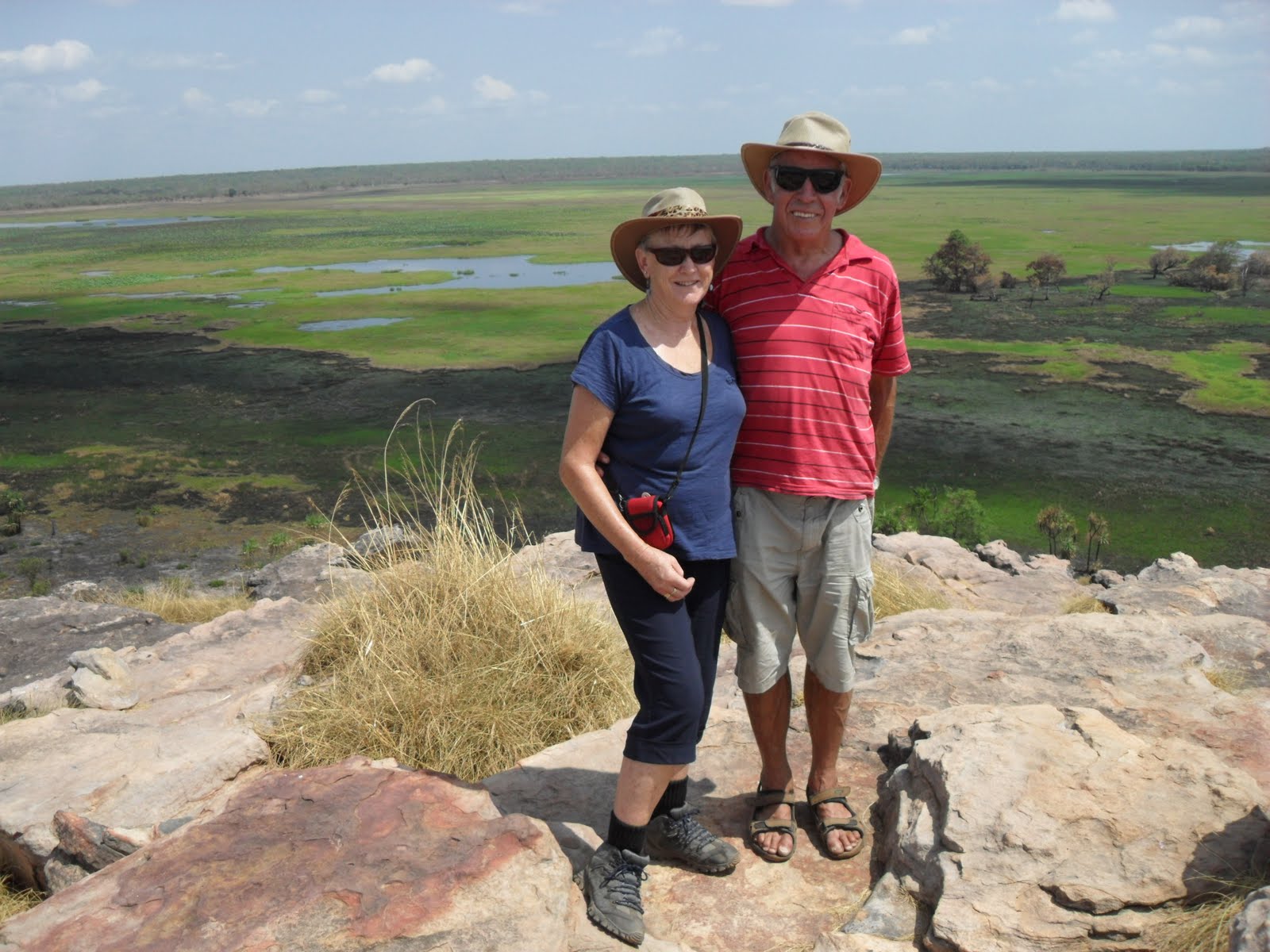
A week in Darwin, then it was on to Kakadu National Park, 250kms east of Darwin. At 130 kms to the gate, another 120kms to Kakadu's main village, Jabiru, and over 20000 kms square, this is the largest park in Australia and only slightly smaller than Belgium. Distances here are colossal – 40 or 50 kms between sights is normal. Raewyn took a 30 minute plane flight over a very small portion of the park, seeing vast escarpments and the huge wetlands in the local area. We then visited Ubirr, where the park borders Arnhemland. Here are Aboriginal rock paintings, believed thousands of years old. At Ubirr, the East Alligator River separates Kakadu from Arnhemland. About 100 metres long, a concrete causeway joins the two riverbanks,allowing vehicles to cross. Upstream from this causeway, the muddy crocodile infested river flows deep. The river is only inches deep over the causeway to the tidal downstream side. From a viewing area, we watched as around five crocodiles lazily floated upstream, heads barely above the water. Apparently, for every crocodile one sees, another six are below the water. They're waiting for any fish which wanders into their territory – or any person who decides to walk across the causeway Signs warn people to not attempt the crossing, but sadly some have, with obvious results.


Litchfield National Park
Swimming at Wangi Falls, Litchfield Nat Park
With most Kakadu waterfalls dried up, and humidity increasing in The Build-Up, we stayed only two nights before heading back toward Katherine, via a two-night side trip to Lichfield National Park, south of Darwin. Not far within the park are huge magnetic termite mounds, some up to 5 metres high. These slab-shaped mounds have their narrowest side facing north, to keep them cooler at the hottest part of each day. The road then winds some 60kms passing other features to the main attraction, Wangi Falls. Here a pleasant waterfall drops into a large lagoon safe for swimming – as long as you don't mind the fresh-water crocodiles (which for the most part are harmless).

Katherine(again)
Now we're back in Katherine, resting, washing and writing this blog before we travel to Western Australia, and new adventures. We hope you join us. For those interested in this part of Northern Territory, I recommend reading “We of the Never Never” by Jeannie Gunn, a delightful tale of farming in the 1900s. This book will add a new dimension to your experiences in this wonderful area.


Monday, 5 September 2011

Mt Isa - Alice Springs

Australia August 2011
Travelogue 10
Stage 2 Mt Isa – Alice Springs
from Bryan and Raewyn
Web: austadventures.blogspot.com


Camooweal
Our last newsletter (#9) was from the mining city of Mt Isa, in western Queensland, where we stayed a week with our nephew and his family. After our goodbyes, we again moved westward and some eight hours later arrived at the tiny outback town of Camooweal, just east of the Northern Territory border. We'd been recommended a camp site there, beside the Georgina River. A wide grassy area on the riverbank became our charming home for the next two nights.

In winter (as now) the Georgina River dries to a series of long food-rich lagoons, haven to thousands of birds. Ducks, shags, tall brolgas, graceful egrets, swift kites and many others which we couldn't name surround the lagoons. Late each afternoon, birdwatching was a pastime enjoyed by the many campers along the river bank. Kites would swoop down beside us, grab unlucky fish in their talons and fly off into the blue sky in one movement, gulp it down, then turn for another swoop. Luckily, the 1.5 metre high brolgas on the opposite river bank stayed there – these birds, similar to a small emu, are quite aggressive and can kick and bite if approached. Sunrise each morning was a pink glow reflected in the lagoons, lasting only a few minutes before exploding into another clear blue day. A kilometre up the road was “Drovers Camp” where the locals have an exhibition hall recalling the old droving days, a credit to the efforts of the local community in this isolated spot.

Three Ways
Crossing into the Northern Territory on the 29th July, it still took two days to reach Three Ways, a renowned tiny dot on the Australian map. Here, you have a choice of going, well, three ways. Back east, some 500kms behind us, was Mt Isa. North some 1100kms away lay Darwin, and south 500kms distant was Alice Springs.Extremely long and almost straight flat roads led in each direction and small shrubs and rusty grasses covered the stony country to the flat horizon, about 50kms distant. From there, a brilliant blue sky soared above us, untouched by even a cloud. It was then a realisation that the vastness of this country can only be felt, not photographed.

Raewyn between the rocks, Devils Marbles
Having been to Alice Springs in the 'Ghan' train last year for three nights meant 'we didn't have to go back there as it was so far off our intended route.' But, after a short discussion at Three Ways, knowing we were 'only 500kms from Alice' we decided to go again. First stop was 23kms down the road at Tennant Creek to refuel and stock up, then onto an overnight stay at Bonny's Well, some 90kms farther south.
Sunset at Devils Marbles
Devil's Marbles
The next night found us at Devils Marbles, a remarkable area where huge rocks balance on each other, as though some giant has been playing with blocks. Tracks led to the tops of many of these rocks. Raewyn and I got to the top of the highest rock pile and were rewarded with an uninterrupted view over the surrounding scrub-covered desert. A smoky haze from grass fires beyond the horizon filled the evening sky leading to an amazing sunset and next morning, before we left, dingoes walked nonchalantly through the camp, unafraid of any people.


Devils Marbles-20m high column

Alice Springs from Anzac Hill, MacDonnell Ranges bey
Alice Springs
A night at another rest area,Connors Well, then we reached Alice Springs on Tuesday 2nd August. Alice Springs is the iconic red heart of Australia, so we settled in for a week, visiting the School of the Air (which transmits to children on distant cattle stations,) the Flying Doctor Headquarters, other local sights and even watched the Ghan train arrive – after all, we were now locals.


In our caravan park, we befriended a young family of four whose 4WD had broken down at Curtin springs, some 400kms west of Alice Springs. After a $1600 tow to Alice Springs and being told their vehicle might not be fixed for six of their seven weeks holiday, we took them under our wing to show them the local sights. Two days later, we all took a road trip following the eastern MacDonnell Ranges to Ross River Resort, 85kms east of Alice Springs. At the resort, it was obvious some maintenance was going on, and after a short conversation with the manager, I was offered a job as extra handyman at the resort. For 16 hours work, we were offered a week's camping plus meals, starting two days later. Fortunately, our befriended family's vehicle was fixed by then, much to their delight. It meant they could pick up their 4WD before we left them to start work at the resort

 Kings Canyon
Holidaymakers at Kings Canyon
 A highlight at Alice Springs was a bus tour on Tues 9th August with our new family to Kings Canyon, only 480kms each way. The bus picked us up at 6,30am, and the 3 hour hike around the tops of this ancient horseshoe-shaped canyon meant all our muscles were tested, though the views were unsurpassed, and whitewashed ghost gums contrasted with the rustic rock strewn background. We were back at the caravan park at 11.30pm that night, tired but happy. Next day was a rest day – if washing and shopping are considered rests.


Ross River Resort
Ross River landscape
Ross River- we had to cross this twice a day.
We'd wanted to stay near Alice Springs for the annual Henley-on-Todd Regatta a week later, so going to Ross River Resort was an economic move, rather than stay in the Alice Springs caravan park.  Thursday 11th August, we shifted to the resort, the last 200 metres driving across an almost dry sandy Ross River to reach our camp ground. That afternoon we started work, helping re-clad and paint several forlorn cabins The rule was if the stress level reached 0.5, we'd all stop for a cuppa. Leaving our camp ground, even to 'work', meant crossing the wide Ross River, driving through water for the last 15 metres. We became quite adept at driving across the sand, though others came to grief.

We worked on and off for the next ten days, and used our off-time visiting local sights such as Altunga, an old gold-mining area where tunnels riddle the ground and many of the old stone buildings have been authentically reconstructed. Some mines have been reopened for exploring by sightseers.  It's a tough countryside here. Fresh water is close to non-existent, the air hot, the ground hard and unforgiving.  Some mining families walked over 600kms to reach Altunga, which in the 1800s was bigger than Alice Springs– very few walked out any richer, and many died and are buried in the local rusting cemetery, last vestiges of the graves barely seen.
Henley-on-Todd River Race


Henley-on-Todd
One of the big boats-armed and ready to battle
The “Henley-On-Todd” is a famous boat race held annually in Alice Springs. This year, August 20th was its 50th anniversary. The problem with these races is for most of each year, the Todd River, which runs through Alice Springs, is totally dry. This small problem is overcome by not having a bottom on the boats, instead the various crews using their feet to run along the riverbed while trying to remain within the boat sides. As you can imagine, it's a hilarious load of fun, many boats 'sinking' when they turn. The kayaks have their own course – rails laid along the sand, on which they slide. Their oar is a shovel, which is used to paddle through the sand. The finale is the Battle of the Boats, in which three very large 'boats' – a galleon, Viking boat and naval destroyer, each powered by a hidden 4WD vehicle, battle it out for supremacy. Each scurvy crew of eight has high-pressured water 'guns', several flour cannons some containing more than just flour, water balloons, and other secretive weapons. The result is a mad-cap battle in which nobody wins, but all (including some in the audience) are covered in an assortment of water, mud, food colouring and above all, grinning like Cheshire cats.

Alice Springs Again
Raewyn at Ormiston Gorge, West MacDonnell Ranges
After our time at Ross River, we again shifted back to Alice Springs for two nights, using the day between to drive some 425kms on a round route this time following the West MacDonnell Ranges through Ormiston Gorge, Glen Helen, and Hermannsburg. These names might mean little to many people, but knowing this day trip included 70kms of unsealed roads might give some idea of the isolation of these places. Flanking us most of the way, the saw-toothed MacDonnell Ranges were a rugged display of 400 million years old rock outcrops, hot,dry, and desolate in the day's sun. Yet every so often, a river would break through the ranges and form gorges of refreshing water. These oases would have an abundance of green trees and animals, in contrast to the desert like conditions close by.

Notes
Roadside reserves
The roadside reserves where we often overnight are a boon for travellers, Many have toilets,barbecues, picnic tables, water, and rubbish bins. Late each afternoon, anywhere from around four to perhaps forty or more caravans/motorhomes pull into these sites and set up a mini-village for the night. Like ships passing, friendships are made and tips passed on. Next morning, it empties again. The reserves are quite safe with few snakes about, but some are infested with mice. You soon learn to not park too near any high grass, as the mice like to get into a warm motor to chew the wiring.

Driving in Northern Territory
Driving here is unlike any other state in Australia. Once out of main towns, the speed limit for all vehicles is usually 130 kph, but several vehicles travel faster than this, including road-trains carrying three or four trailers. Most sealed highways are long, almost flat, and often almost dead straight for perhaps forty or fifty kilometres. Far from boring, the scenery changes subtly, from desert to green foliage or burnt trees. At this time of year, much of the countryside is being deliberately burned to get rid of the half-metre high dry grasses.  This helps stop major fires from lightning strikes in summer storms, should the grass grow much higher. Smoky haze fills the air for thousands of hectares. We've driven through a couple of fire fronts, with flames beside the road.

Overnight, the roads are best left to the huge rumbling 53 metre long road-trains. It's safer for smaller vehicles to stay off the road at night.  Many large wild animals- camels,emus, kangaroos,cattle, horses- wander onto the roads at night. The road-trains don't slow down, and with their huge roo-bars, several animals are killed each night. The eagles, falcons and crows don't mind and each morning it's a feast of road-kill meat for all of them.


Monday, 25 July 2011

Australian Adventures (9) July11

Australia July 2011
Travelogue 9  Stage 2 

Daintree – Mt Isa
from Bryan and Raewyn
Web: austadventures.blogspot.com

Daintree
Our last travelogue (#8) saw our arrival at a friend's property, in the world-heritage Daintree Rainforest area on the north-eastern part of Queensland's coast. Fifty kilometres south was Port Douglas, an upmarket resort area with boutique shops and cafes. Fifty kilometres north, after a roped-ferry crossing across the crocodile-inhabited Daintree River, was Cape Tribulation, where the rainforest meets the sea. This was as far north as we got. After two and a half wonderful weeks in Daintree, it was time to move away from the coastline which had accompanied us from Melbourne, so on July 6th we headed inland, away from the coast.


Rasewyn photographs the Kuranda train
Mareeba
Our drive took us through Mossman, then west across the Great Dividing Range. This range almost parallels the east coast from the northern tip of Australia to Victoria. East of the range is 90% of Australia's population. West of it is the other 10%. Atop the range, and midway across the rolling green Atherton Tablelands is Mareeba, a charming country town with a delightful caravan park in the rodeo grounds. We spent five days there, exploring local towns and sights, including driving again to Kuranda, the tourist town near Cairns. This time, instead of our taking the “Skyway” gondola back to Cairns, we waited until 3.30pm and watched the last train leave. Within minutes, the roller doors came down across most of the shop fronts and the town became deserted, except for a few rumpty locals. The town seemed to have ceased to exist, or at least until the next morning when more hordes of tourists arrived


Bryan straddles the Gulflander train at Croydon
Croydon
Croydon's main street
Croydon cemetery
From Mareeba, travelling westward took us off the tablelands, into the true Queensland outback. A hot, dry 280kms drive along the Savannah Way, the road bordered with rust-coloured grassland and small trees, took us to an overnight stop at Mt Surprise. Next day another 260kms drive west across the sunburned landscape found us in Croydon, and a 120 year step back in history. The local general store in this old gold-mining town opened in 1884, and is still operating today, both as a store and living museum. 
Many town buildings have been renovated and reopened in their original livery, complete with displays and photographs from the late1800s. Close by, the Croydon cemetery spoke silent tears of the hardships faced by the long-gone families, and children, in this dry unforgiving landscape. Many of the rusting graves hold conch shells, some virtually undisturbed since they were placed there in the late1800s. In the Chinese section, stones inscribed with Chinese symbols lie at the foot of each grave, and lizard tracks cross the red dust between the rows, separating Chinese from Catholic, Catholic from Presbyterian, rich from the poor.

Croydon is also the eastern terminus for the heritage-listed “Gulflander Raillcar,” a weekly 'service' from Normanton, 140 kms away. The 2-car 'railmotor' takes an incredible five hours to make the journey at a hair-raising speed of 40kmph across the scorched landscape. It returns to Normanton the next day. That's it for the week. It's been doing this for 120 years, and big celebrations were afoot in Croydon to celebrate the occasion later in July – unfortunately after we had left.

Leichhardt’s Lagoon
Leichhardts Lagoon sunset
Leichhardt's Lagoon camp-note the dust
Several caravanners had recommended a unique camp called Leichhardt’s Lagoon, our next stop. On a private station, our site overlooked a large lake where sunset each night was a scarlet sky deepening to a maroon glow before clusters of stars filled the night sky, much of this reflected in the lake. Though still 27 kms from Normanton,and with no electricity supplied, we stayed four nights. Camp fires and pets were allowed, and the ablutions block with its corrugated iron walls, gas-heated hot water, and green tree frogs commonly in the toilet bowls added to the novelty. Washing machines were “Free - Just bring your own generator” and the local telephone booth was a plastic chair and a tall booster-aerial wire – 'bring your own phone and connect up.'

The reason to not swim at Leichhardt's Lagoon
Each night was 'happy hour' at the caretakers' caravan- take your own chair and drinks. On Saturday nights a 3-course meal was prepared by the station owners at their homestead grounds on the other side of the lagoon. Soup, mains and dessert all for $5 each, proceeds donated to the Royal Flying Doctor Service. Just bring your own chairs, table, drinks, plates, cutlery and insect repellent'

Life size model of crococodile shot near Normanton,Qld
Some 27kms west of our camp was Normanton, western terminus for the “Gulflander” and gateway to the Gulf of Carpentaria. About 73 kms north, the sealed road ended at the small town of Karumba - interestingly the only sealed road to the coast on the western side of Queensland. Karumba is fish, fish and more fish. If you're not into fishing, there's little else to do. Some folk go there year after year. A day at Karumba was enough to satisfy our curiosity, and we drove the 100kms back to our camp at the lagoon, just in time for happy hour, of course.

Mt Isa from lookout

Mt Isa 
Tuesday July 19th ,we left Leichhardt's Lagoon, headed south, and followed the Matilda Highway through Burke and Wills Junction to Cloncurry and Mt Isa, overnighting along the way at “Terry Smith Lookout” a small roadside reserve, where amazingly another twenty or so caravans or motor-homes pulled in for the night.

There's no doubt the famed annual “Grey Nomads” migration is well under way. It's suggested each winter some 60,000 “grey nomads” from Victoria and South Australia make the pilgrimage to the warmer north, and the inland roads abound with herds of them travelling in their mobile homes in various directions. Nightfall sees instant small towns created in roadside reserves, then dissipating the following morning. We are part of it, and it's a great experience.

Wednesday July 20th we arrived at our nephew's property in Mt Isa. We had been out of phone contact for the previous ten days, and on arrival had several messages awaiting us. Sadly, one of them was that our very dear friend and long time caravanning buddy, Ron Martis, had suddenly died in Rotorua, New Zealand the previous day (Tuesday 19th). Some of the places we visited in Australia were on his recommendation. The rest of the day was spent in limbo, and though we tried, we couldn't make it to the funeral, but managed to watch the service via Skype, courtesy of our daughters.


Lake Moondurra, 18kms from Mt Isa
Mt Isa, with a population around 20,000, exists mostly to serve the huge mining complex on the western edge of the city. Tall chimneys dominate the landscape. Some 450kms of tunnels honeycomb the 27 levels underground. 18 kms away is Lake Moondarra, an artificially created lake supplying an increasing demand for water in this alien landscape. Anywhere out of the city, the landscape turns again to semi-desert. Closest next town is Cloncurry, 117 kms eastward. Mt Isa is an oasis of energy in an ancient land.

Attached to the Tourist Centre, is the “Hard Luck” mine, an experience created solely for visitors. A miners' lift lowers two floors to an awaiting miners' train which takes visitors to various mining activities. All equipment, including the train, is authentic - including having to wear bright orange overalls, helmet and miner's light. Not being for the claustrophobic, Raewyn preferred to go shopping.
Beware of 53 metre long road trains in Queensland outback.
Stay with us as our next journey continues westward across this huge country.
                               (Hint - double clicking on the photos above will enlarge them)


Saturday, 9 July 2011

austadventures.blogspot.com(8)


Australia June 2011
Travelogue 8
Stage 2 Whitsunday Islands-Daintree
from Bryan and Raewyn Jenkins
Web: austadventures.blogspot.com

Whitsundays
Seaflight

Our last travelogue (#7) saw our arrival at Airlie Beach, in the Whitsunday Islands area of the east coast of Australia. This has to be one of the most scenic parts of Australia,and a major base for cruises to the Whitsunday Islands and Great Barrier Reef. We stayed eight days and went on three cruises during that time.

Monday May 30th dawned brilliantly fine, an idyllic day. Our boat, “Seaflight” knifed across a barely rippled sea to the Great Barrier Reef. On arrival our boat tied up to a large covered pontoon, which became our base for the day. All around, the horizon was a straight line broken only by the slight peek of the Australian mainland, some 95 kilometres from where we had started. In the other direction about 200 metres away, Pacific ocean swells broke over the outer reef. The water was blue and warm, and the crew told us our day was the clearest water they'd seen for some weeks. We were in luck

Gt Barrier Reef Pontoon
From the pontoon, one can go tripping in a glass-bottomed boat, underwater viewing in a semi-submersible, snorkelling about the reef, or at extra cost, scuba diving or a helicopter flight. We opted for the glass bottomed boat, semi-submersible and snorkelling. All snorkelling equipment is supplied, including 'noodles' to keep you afloat, plus a floating rope extending some 60 metres from the pontoon to a fixed buoy, allowing you to pull yourself along while viewing myriads of fish and coral below. It made snorkelling so easy that after a few anxious moments, we both dived in and felt at home though the water was ten metres deep. Below the surface, the reef was alive with fish of all types, and the corals amazing.

Gt Barrier Reef Pontoon (95kms from land)
Lunch was provided on the “Seaflight” (as were morning and afternoon teas) After a long and relaxing lunch, some folk preferred to laze in the sun. others took once more to the water. All up, we were at the reef about four hours.

On the way back to port, Raewyn 'won' a free cruise for the following day on the “Camira” after a contest aboard our “Seaflight.” Rather cunning, as we then had to pay for a second ticket, but at least managed to barter the price down somewhat – it being 'winter' and the lack of tourists, etc.

The “Camira” is a 23 metre sailing catamaran and this trip was slow and monotonous, the views restricted to one or other side of the boat at any one time. Again, all food was provided, including this time free beer and wine , a small consolation for the discomforts. The crew were excellent, if a little overworked raising and lowering sails and keeping guests from tangling themselves in the ropes and sails. The wind was barely enough to fill the sails, so the highlight was going ashore for an hour at Whitehaven Beach, on the ocean side of Whitsunday Island, while the crew prepared lunch.

Whitehaven Beach, Whitsunday Islands
Wednesday June 1st,we went on a third cruise,this time on “Voyager”, visiting three islands in the Whitsunday group. Again, we went to Whitehaven Beach on Whitsunday Island, but stopping off on the way at Hook Island for some snorkelling off the beach, plus a semi-submersible trip along the local reef. Next stop was Whitehaven Beach. This 7 km long beach has to be the highlight of any trip to the Whitsundays. Crystal clear water lapping fine white silica sand, an azure sea beyond. As with all our time in this area, we had blue skies, and only the slightest of breezes. Postcards don't do this area justice.

We'd also pre-arranged a short float plane flight from Whitehaven Beach, and around 1pm took off in a 50 year old single engine aircraft for a figure eight circuit around Whitsunday Island. The view from above was outstanding, and the flight all too short. Landing back in the sea was exciting stuff, a flurry of spray and we were down, smiles from ear to ear.

From Whitehaven Beach the “Voyager” took us to Daydream Island. This is the ultimate holiday island – a five star resort with hotel, chalets, shops, pools, theatre, and no cars. Perfect for the wedding we saw taking place there.
Airlie Beach, Queensland

There's 74 islands in the Whitsundays group, and most are national parks. There is more to this area than just the islands and reef. Airlie Beach is an easy-going town, very much a back-packers paradise, the hill behind the town spills over with a plethora of apartment blocks. Close by are beautiful bays and protected inlets, many walks and other activities. Airlie Beach residents lay claim to theirs being the friendliest town on the coast, and it shows.

Bowen
From Airlie Beach, it was on to Bowen for three nights. Bowen's fame revolves around where the film “Australia” was shot. The jetty (in the film) is real and one can walk along it. Though most of the sets have gone, Bowen's character is still very much 1940s. It's old hotel facades and shop fronts make you feel as though you've entered a time warp. Bowen residents though are very friendly, and welcoming.

Townsville
Next stop was Townsville, with the monolithic 285 metres high Castle Hill in the heart of the city being the main feature of the area. The steep three kilometre drive to the top is rewarded with views over Townsville to Magnetic Island some seven kilometres away. The coastline in this area, known as the Coral Coast, is dotted with islands, and there's cruises to many of them.

Mission Beach
Moving north, we spent three nights at Mission Beach, where Cyclone Yasi made landfall in February this year. There's still a lot of damage around - houses with roofs or windows missing, and thousands of trees lying where they fell in the forests, or strewn alongside the roads and beaches. The folk there are making the best of it, but it will be a long road to recovery. Bush walks led us to a few viewpoints, where large and aggressive cassowary birds live, but we failed to spot any, though apparently they were there. Most beaches along this coast are edged with coconut palms, the nuts laying on the ground in various states of decay. Fresh nuts could be opened and eaten, but most people seemed to leave them where they fell.


Cairns fruit bat (this picture is upside-down1)
Cairns
Next stop, and last major city heading north, is Cairns. This is where we saw our first fruit bats hanging by the hundreds from city trees. Only the most unwise park their cars under those trees and the paths below were littered with bat droppings.

7kms long Kuranda Skyrail
The reknowned tourist feature in Cairns is the Kuranda Scenic Railway and Skyrail. The beautifully restored train leaves Cairns and winds 25kms through rugged hill country to Kuranda village, stopping on the way, for obligatory photographs, at the mighty Barron Falls. Kuranda village is the typical tourist village, with high priced food and every trinket imaginable, but our strolls around the village were rewarding. Returning to Cairns on the Skyrail is a worthy experience. The cable-car winds for 7 kms above the rainforests, taking some 35 minutes to bring us back to where our bus awaited for the return trip to our caravan park.


Scarface-4.5mt Daintree crocodile
Daintree
From Cairns, it was a quick run through on 18th June to our friends living in Daintree, far North Queensland. They live amongst the World Heritage Daintree Rainforest, not far short of the end of the sealed road. Across the road, the neighbours property backs onto the Daintree River, from where crocodile spotting cruises operate along the river. We were fortunate enough to be invited on a couple of cruises and saw about six crocs – the first few being about a metre long, the last being “Scarface”, a four-metre male. As we approached, his eyes watched our every move. You sensed there were even more eyes watching us from under the timbers, and the muddy river doesn't reveal anything below the surface – unless you jump in. *

Our friends have just bought themselves a new 4.7metre river runabout, and one Saturday we all went on a fishing run some nine kilometres to a sandbank at the Daintree River mouth. We saw no crocodiles on the way, though on the same trip a week later, we saw three massive crocs sunning themselves at spots along the river.
We've also visited Port Douglas, Mossman Gorge and Cape Tribulation, each a day trip. Cape Tribulation is a car-ferry ride across the Daintree River, then a 30km twisty drive through the rainforest, passing many restaurants and lodges. From Cape Tribulation, it's a 70 kms, or four hours, drive along rough tracks and river crossings to Cooktown. We gave this a miss. It was getting close to Happy Hour time.

Each afternoon, large bright blue Ulysses butterflies visited us. In the short rainforest twilight, wild birds visit, and on cloudless nights, the darkness opens to a garland of starlight. From here, we will be moving inland toward Mt Isa and Darwin and hope you will join us for the next part of our adventure.
Bryan and Raewyn

*I never thought a crocodile, would return my friendly smile
But he did with a grin so wide, I think he wanted me inside